
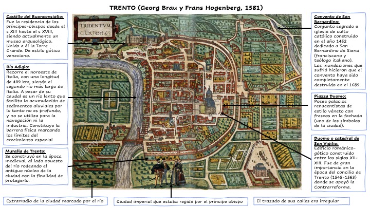
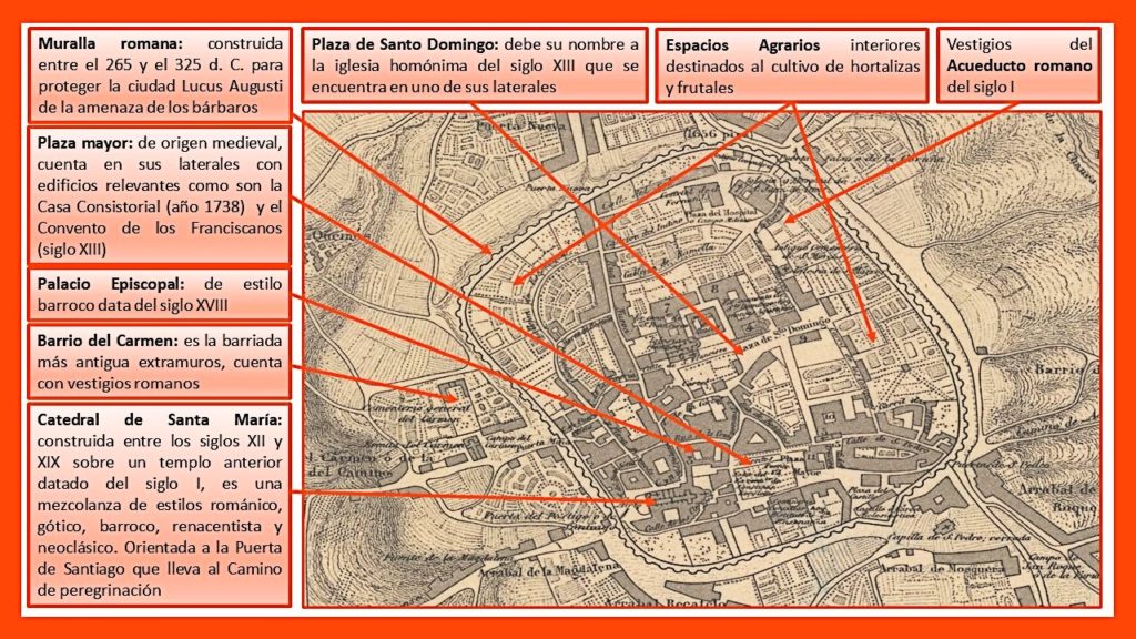
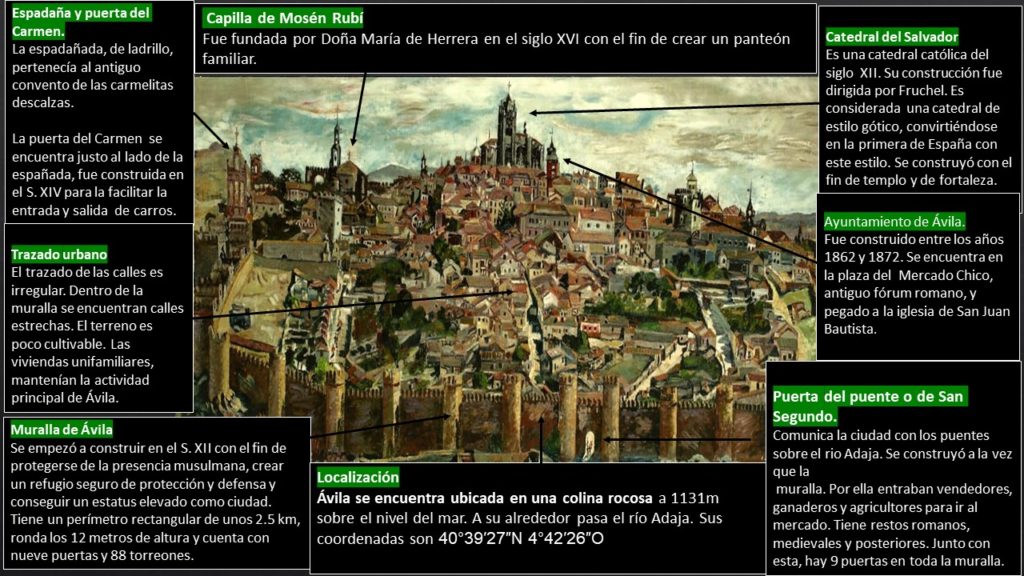
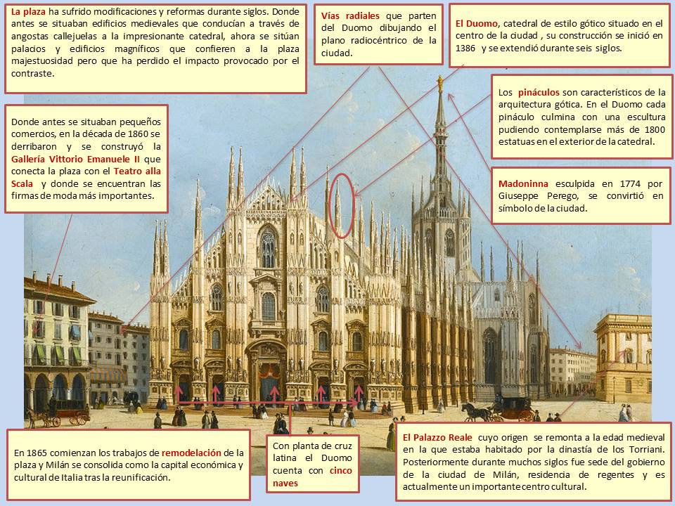
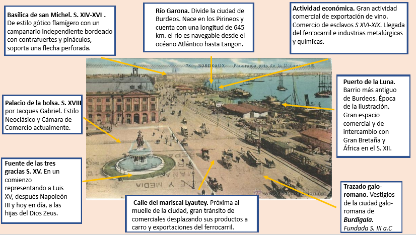
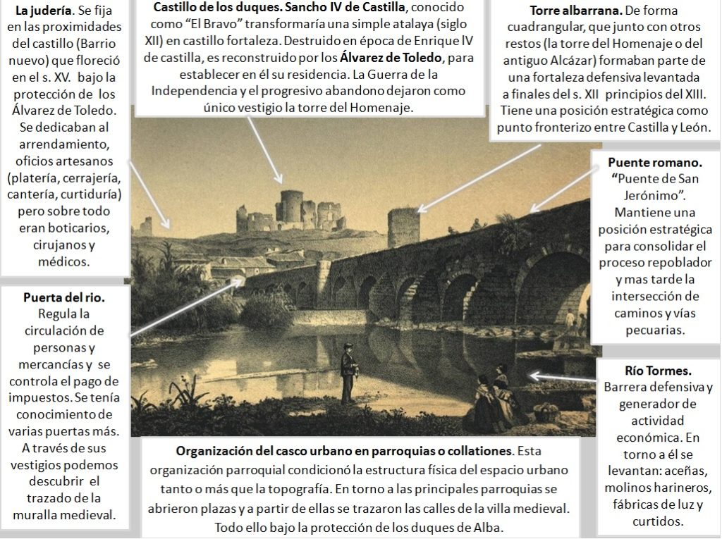
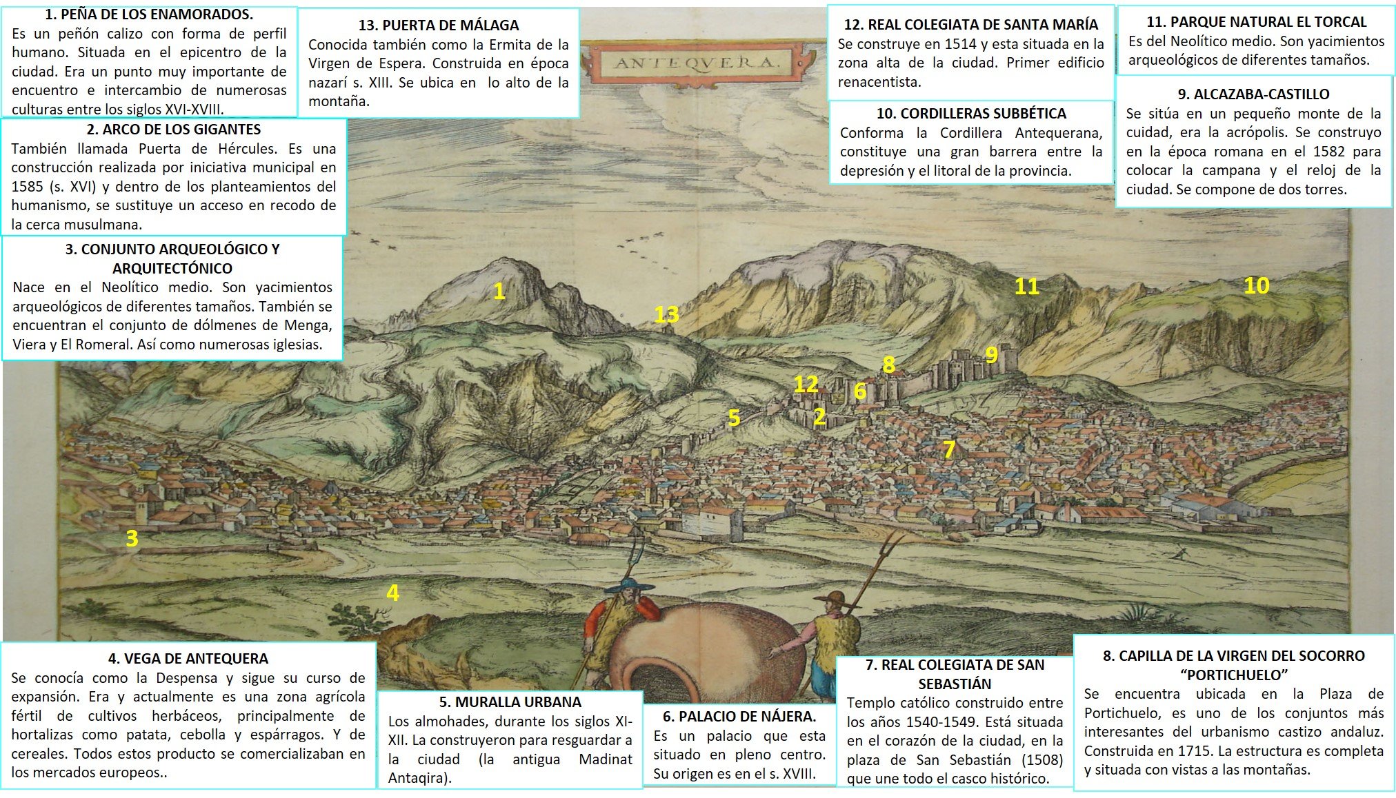
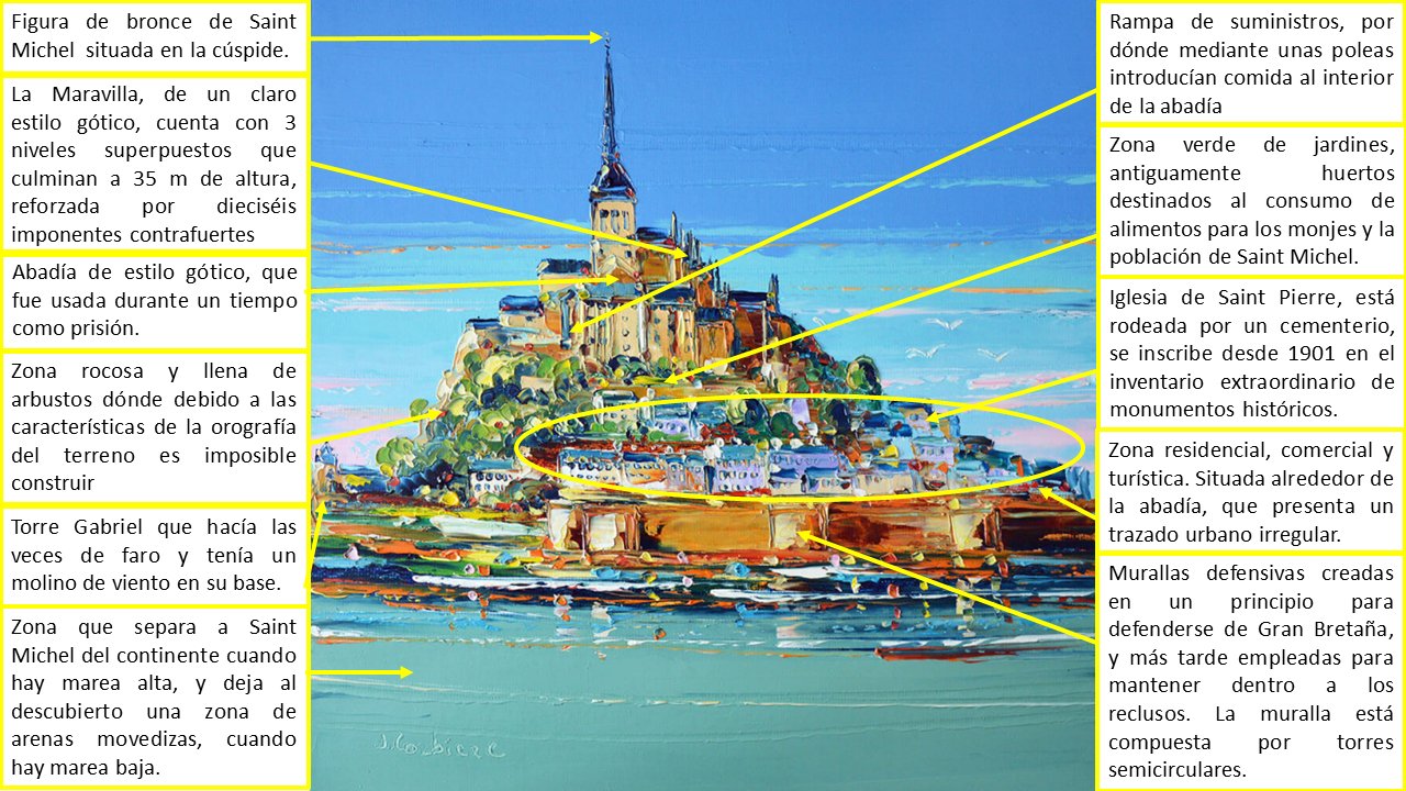
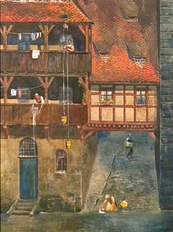
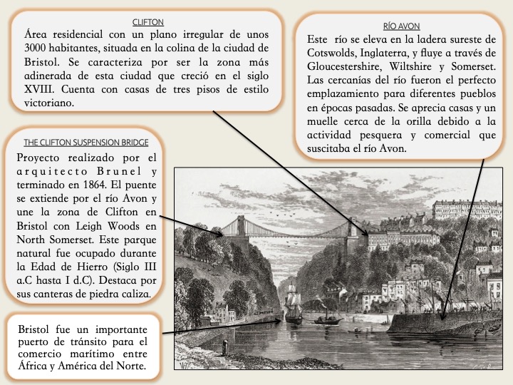
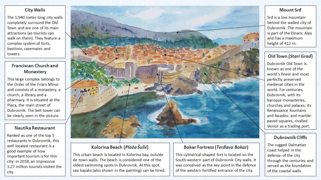
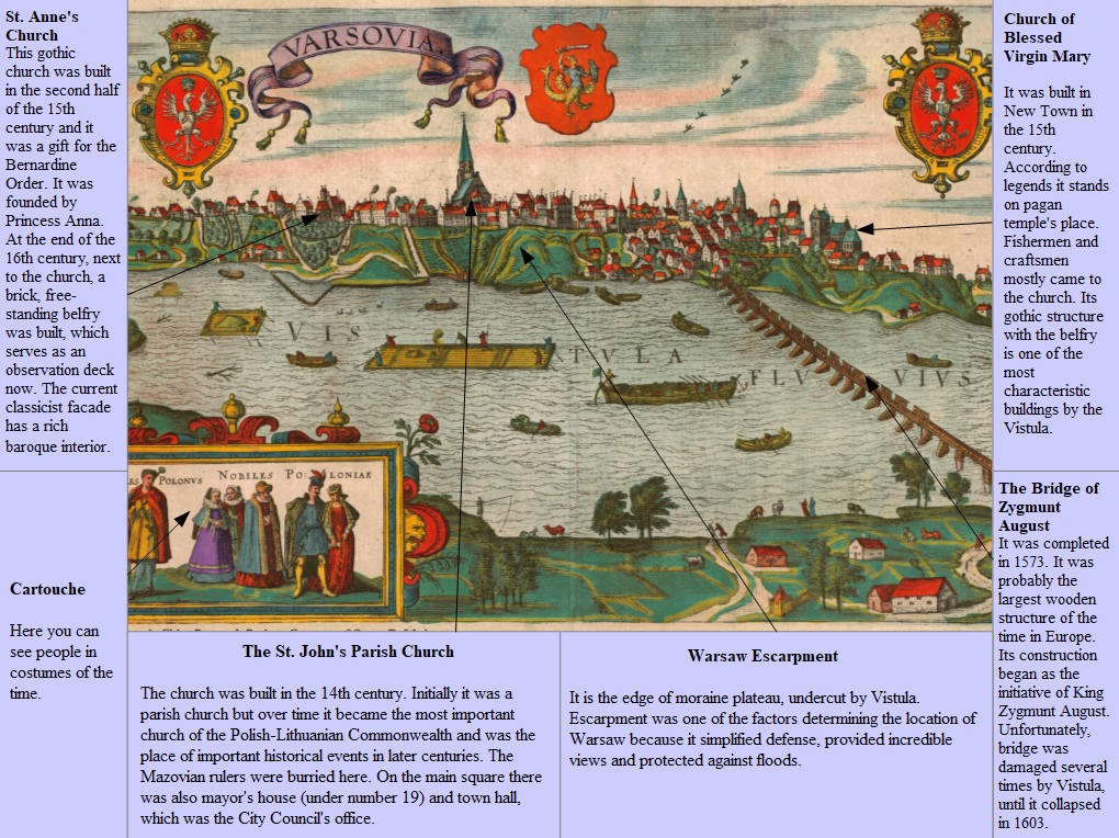
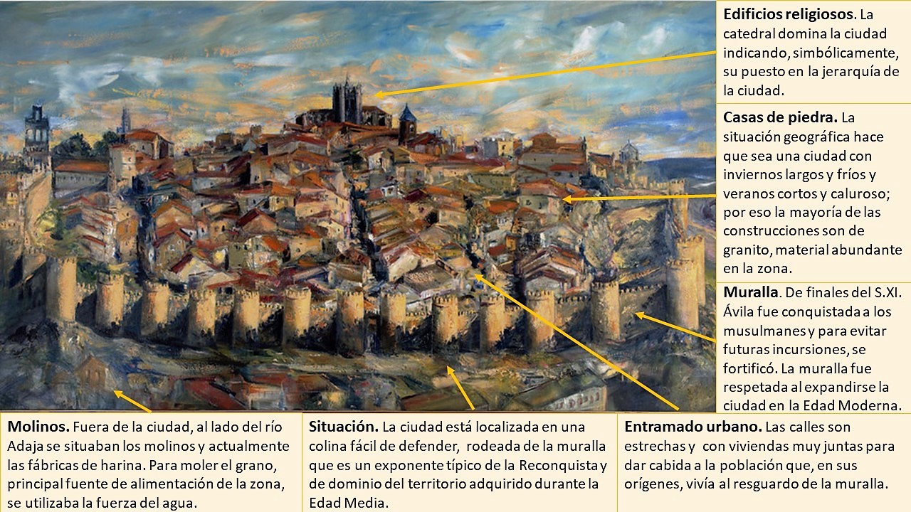
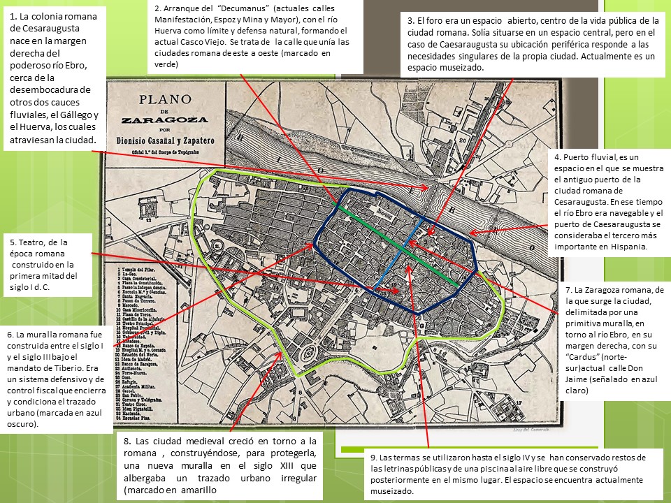
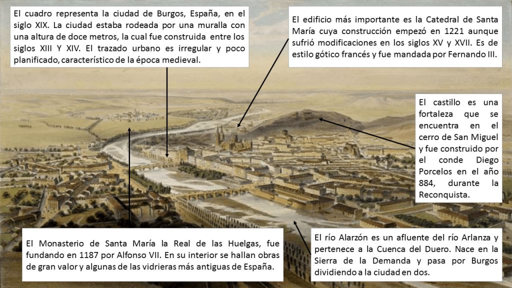
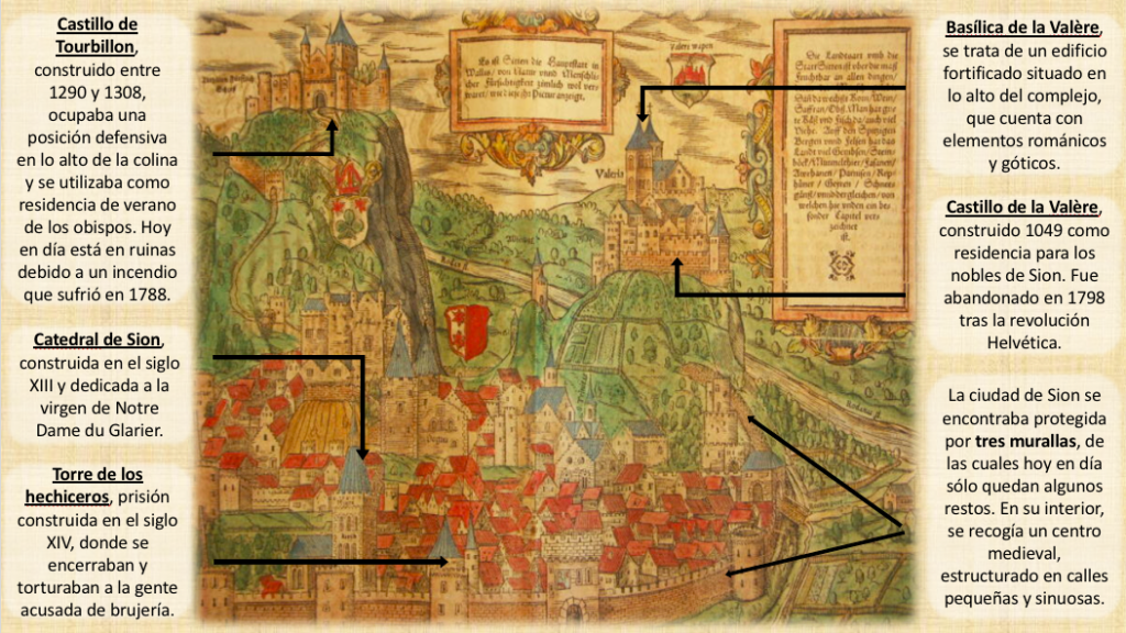
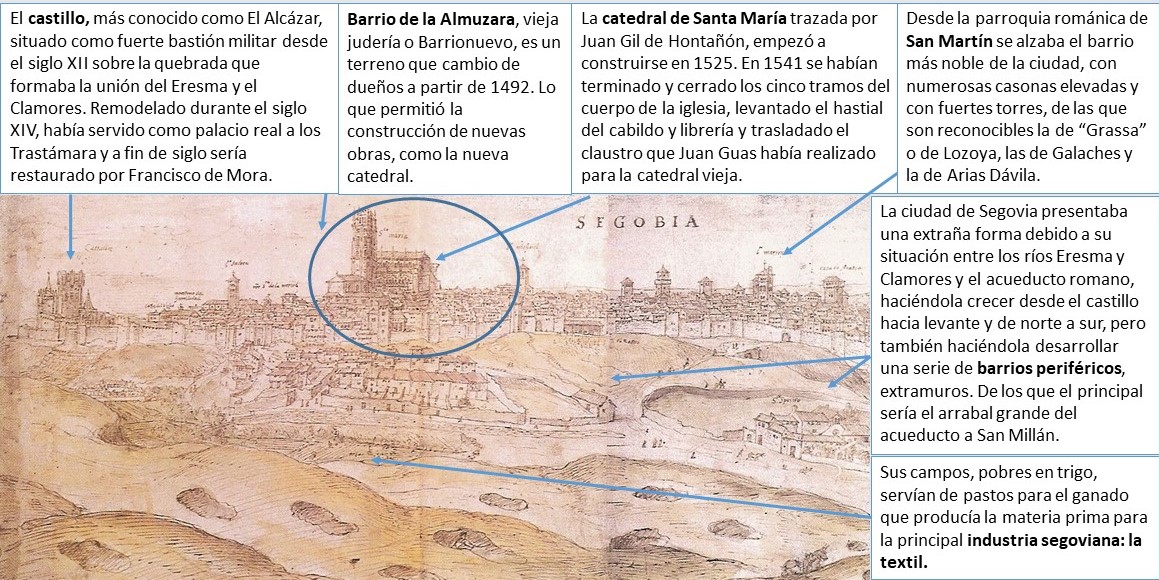
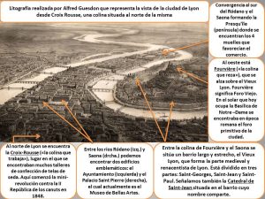
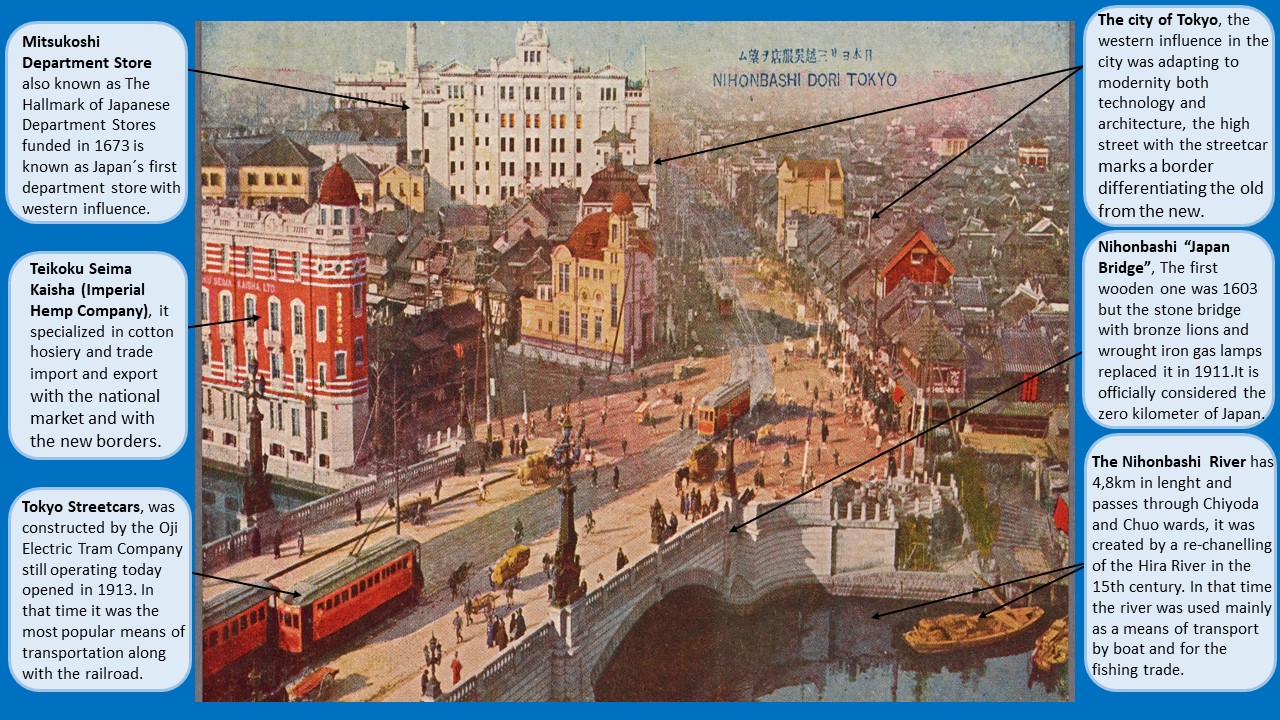
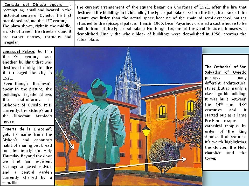
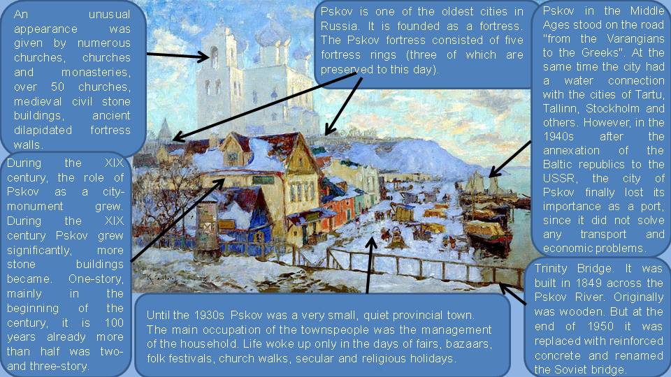
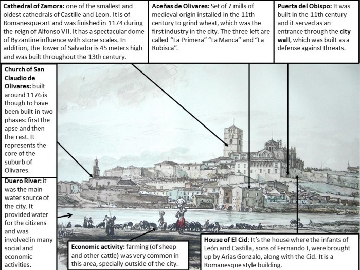
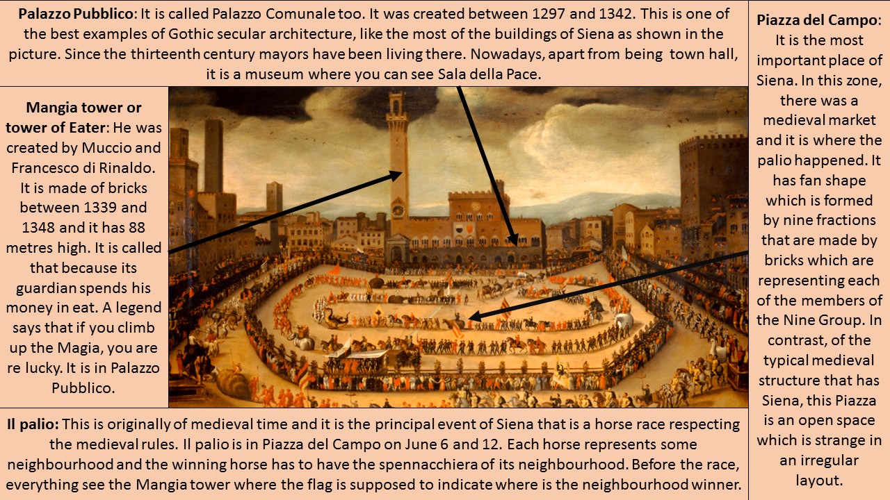
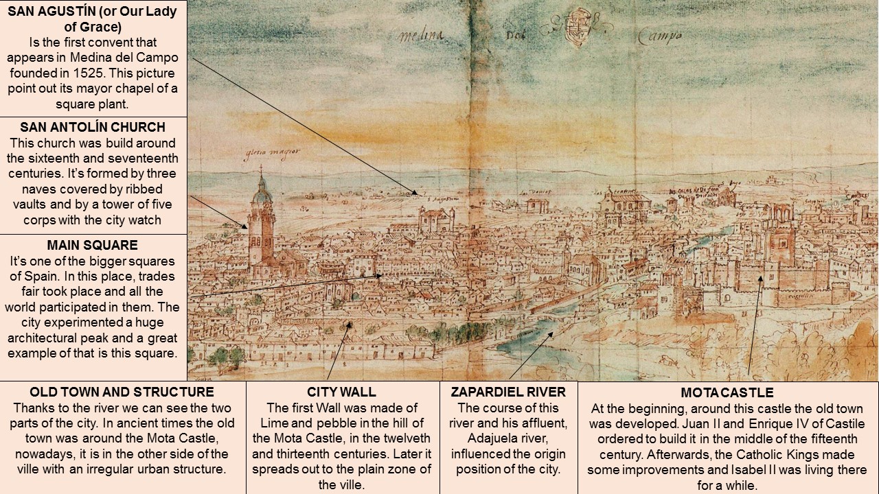
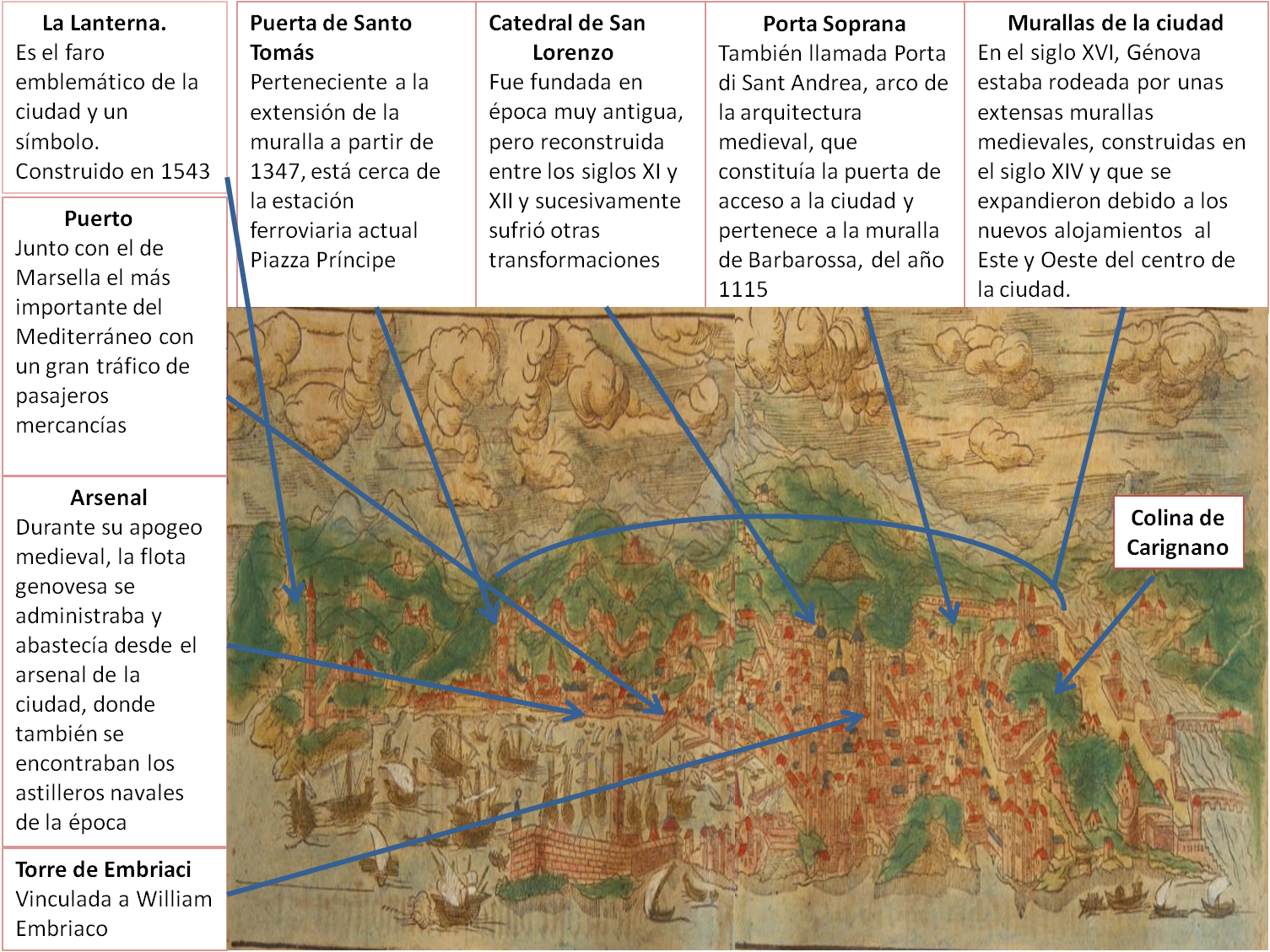
TRENTO (Georg Brau y Frans Hogenberg, 1581)
La provincia de Trento es una ciudad que se encuentra situada en Italia, concretamente en la región de Trentino-Alto Adigio. En un primer momento fue una ciudad celta hasta que en el año 15 a.C. fue conquistada por los romanos. A su vez, en el año 222 a.C. comenzó denominándose “Tridentum” cuyo significado es “tres dientes”, algunos historiadores asocian este nombre a los montes que rodean la ciudad mientras que otros se refieren a los tres ríos que la atraviesa.
La ciudad está ubicada en las coordenadas 46º 04’ 00”N 11º 07’ 00”E, a una altitud media de 190 metros sobre el nivel del mar, en un profundo valle atravesado por el río Adagio y el torrente Fersina. Los montes Doss Trente, Santa Aghata y San Roque se encuentran rodeando la ciudad.
Antiguamente la atravesaban importantes vías de comunicación que enlazaban la Llanura padana (región geográfica del norte de Italia) con los territorios allende de los Alpes pasando Resia y Brennero. Sin embargo, esta ciudad se volvió conocida por el concilio con el que se apoyó la Contrarreforma (1545-1563). La contrarreforma, cuyos objetivos eran renovar la iglesia y evitar el avance de las doctrinas protestantes, fue la respuesta de la Iglesia católica a la reforma protestante de Lutero, el cual había debilitado a la Iglesia.
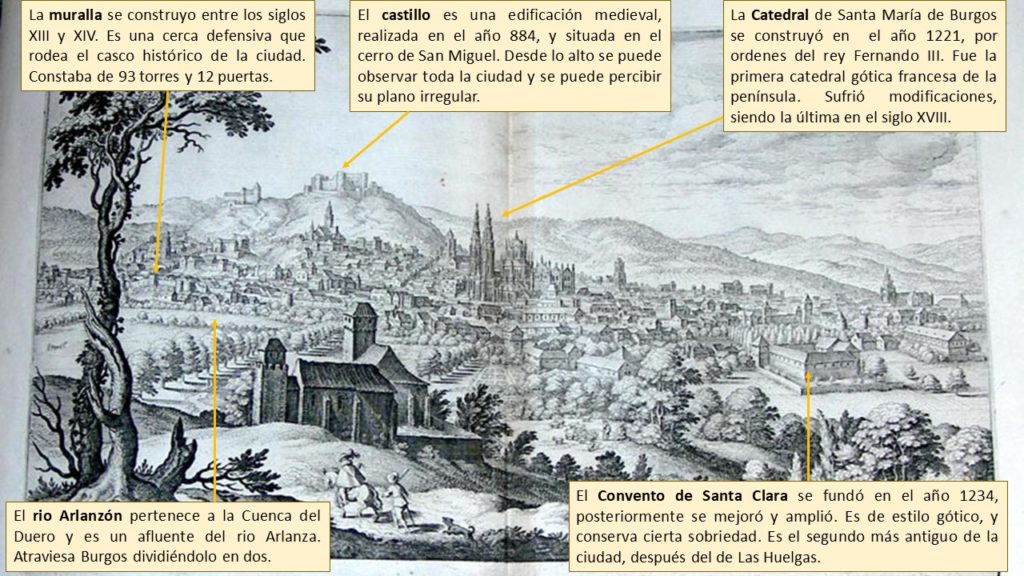
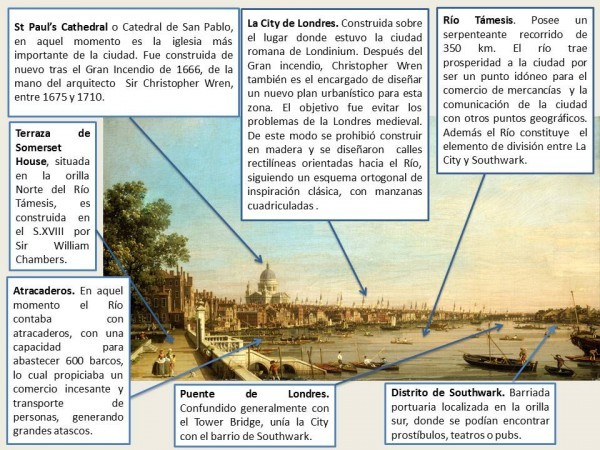
La imagen que se comenta pertenece a un plano urbano irregular de una parte de la ciudad de Trento del año 1581, es decir, un tipo de diseño urbano de aspecto anárquico sin forma definida, las calles no siguen un orden previo y se presentan desordenadas, siendo estrechas y generando una percepción de laberinto, cuyo autores son Georg Brau (1541-1622) y Frans Hogenberg (1535-1590) y procede de Civitates Orbis Terrarum, un proyecto concebido como un complemento del atlas del mundo de Abraham Ortelius, designado como la más completa edición de vistas panorámicas, planos y comentarios textuales de ciudades de la Edad Media. En ella se muestra el principal núcleo de la ciudad situado en el centro de la imagen, rodeado por una gran muralla propia de la edad medieval, la cual servía como mecanismo de protección y defensa, propiciando un trazado denso y apelmazado, en el que no se dejaba mucho espacio para lugares abiertos y amplios. En el siglo XVI esta zona se trataba del casco histórico de origen medieval, donde se realizaban las principales funciones, localizándose ahí la Piazza Duomo, construida en el XVII la fuente de Neptuno para adornarla. Esta plaza, además de la fuente mencionada poseía principales palacios renacentistas de estilo véneto con frescos en la fachada, representando uno de los símbolos de la ciudad. A su vez, en esta localización se ubica el Duomo o la catedral de San Vigilio, uno de los edificios más renombrados de la ciudad. Es un edificio románico-gótico construido en los siglos XII-XIII que cobró gran importancia durante el concilio de Trento. Actualmente tanto la plaza como la catedral son uno de los destinos más frecuentados por los turistas por su importante papel histórico. Por otro lado, el río que se observa en la imagen actúa como barrera física marcando los límites de crecimiento espacial de la ciudad. Unido a esto, se puede observar al otro lado del río el extrarradio, es decir, la parte fuera de la línea de fijación, en la que se muestran tierras y polígonos.
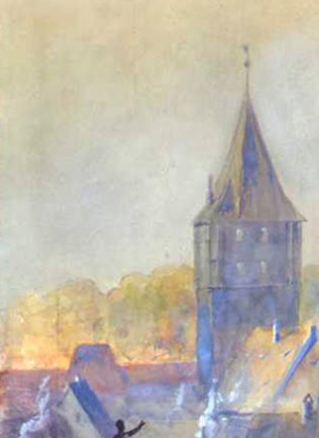
El segundo de los edificios más destacados de la ciudad es el Castello del Buonconsiglio, cuyo uso principal fue residencial para los príncipes-obispos, los cuales eran príncipes del Sacro Imperio Romano Germánico. Se construyó en el siglo XIII y unida a él se observa la Torre grande. Años después fue reacondicionado con formas góticas venecianas y, en la actualidad, es un museo arqueológico que posee además obras artísticas y etnológicas.
En la parte posterior del plano se muestra el convento de San Bernardino, un conjunto sagrado e iglesia de culto católico de rito romano, que se construyó en el año 1452 con la finalidad de homenajear a San Bernardino da Siena, un predicador italiano (durante más de treinta años) misionero franciscano y santo católico. Sin embargo, a pesar de numerosas obras debido a las violentas inundaciones que ha experimentado a lo largo de los años, en 1689 terminó siendo completamente destruido, decidiéndose finalmente construirse un nuevo edificio, en una zona diferente fuera de las murallas de la ciudad, el cual, actualmente sigue dedicándose al servicio religioso.
Es importante destacar que, como se observa en el plano, una gran superficie de la ciudad, de los 6.207 km² que la definen, pertenece a tierra montañosa, cubierta por vastos bosques (50% del territorio). Esto favorece la plantación de manzanas y recogida de vinos denominados como productos de origen. A su vez, se observa la presencia del río Adigio, cuya longitud es de 409 kilómetros, siendo el segundo río más largo de Italia. Sin embargo, a pesar de ser muy caudaloso facilita la acumulación de sedimentos aluviales y, al no ser profundo no es posible utilizarlo para la navegación ni la industria.
Ligado a esto, en 1966 Trento conoció la mayor inundación de su historia reciente y buena parte de la ciudad y cerca de 5000 hectáreas de campo fueron sumergidas por 2 metros de agua. Por ello, en el 1971 se tuvo que modificar el estatuto especial provocando una gran ampliación de la autonomía de Trento.
Actualmente debido a su clima tan variado, desde alpino al subcontinental, y al terreno montañoso, Trento se mantiene económicamente por influencia turística. Los turistas que disfrutan haciendo deporte al aire libre visitan los Alpes mientras que aquellos que quieren enriquecerse culturalmente visitan el centro de la ciudad, el cual conserva gran cantidad de edificios medievales y del renacimiento.
_Alcal%C3%A1_de_Henares.png)


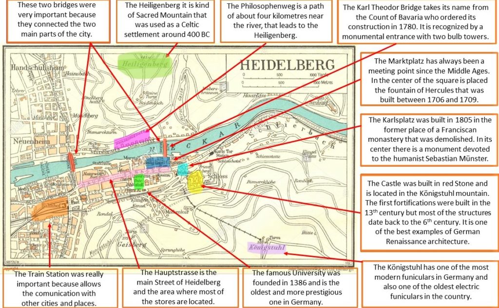


_p012_THE_CITY_OF_EDINBURGH.jpg)
_Belmonte.png)
_-_Pieter_van_der_Aa.jpg)


")


