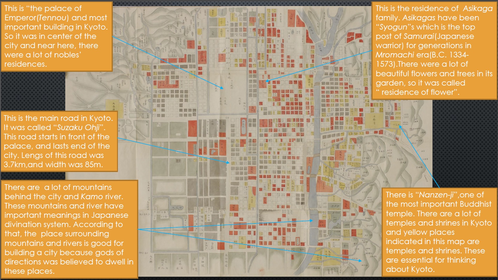
TOKYO-EDO (1632)
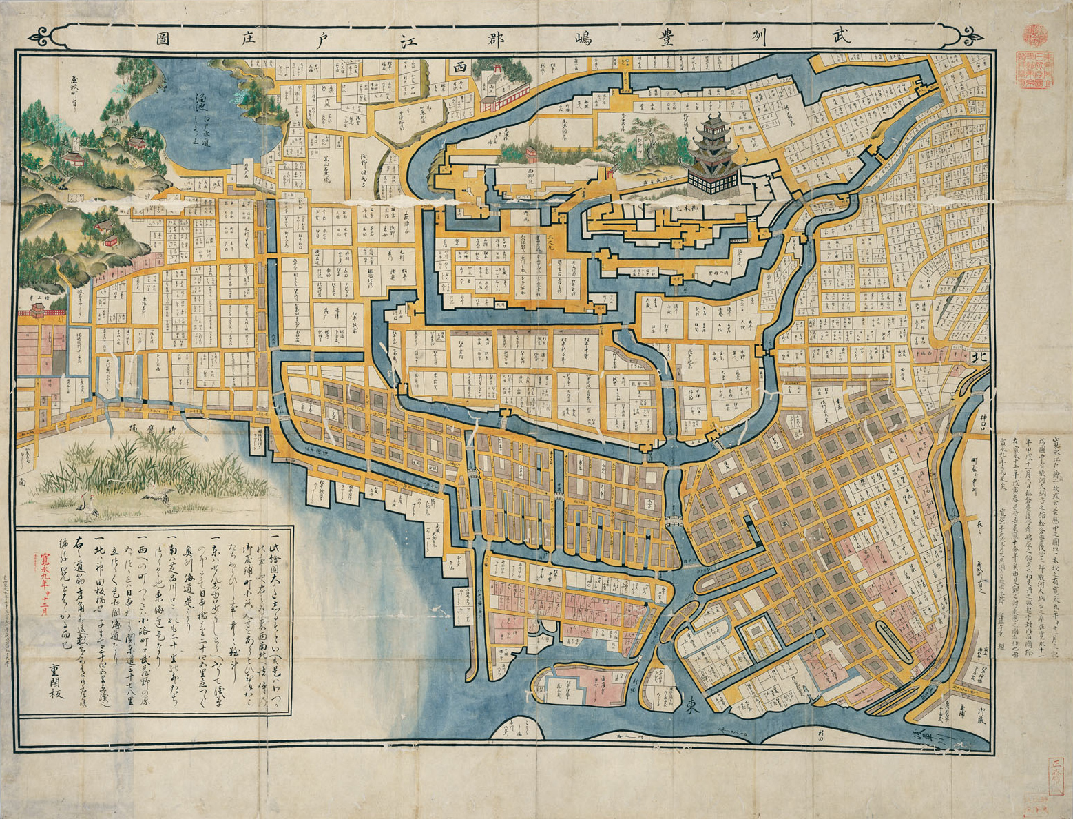
This old map is titled as “Busyu Toshimagun Edo Syouzu,” which represents the overview of city of Edo (an ancient name of Tokyo) in 1632. There are a lot of copies of the map, and the original one belongs to the collection of the National Diet Library. It is known as the oldest map of this city. The publisher is still unidentified, and we can only see the date it has published in the left side of the picture, as “Kannei 2 nen 12 gatsu” with red letters. “nen” and “gatsu” mean year and month respectively, and “Kannei” is a Japanese calendar in this era. In this image, we can also observe that some remarkable landscapes such as the main tower of the castle and Zoujouji-temple were described in pictorial way, while other constitutions were represented in cartographical way. Because of that, it could had been published in a kind of transitional period just before people started practicing authentic cartography.
Although the construction of the city seems complicated, but we can distinguish two different types of town planning inside and outside of the inner moat. Inside of the inner moat, the planning is irregular that centered with the main tower of Edo castle. This area is the center of the government. There are gates with securities for each bridges on the inner moat to restrict admission to the hub. On the other hand, the town planning in the outside is more or less orthogonal. It is not a perfect form of grid because of the tangled moat. However, we can observe typical orthogonal town around the Nihonbashi bridge. This is a traditional form of town planning in this age which is called “Joukamachi,” and it seems totally different from the construction of European cities. However, concerning some characteristics, there are similarities and we can analyze this style as a partial mixed form of irregular and orthogonal.
Regarding the buildings, there are also two types of them we can see. Buildings that has name in this picture, especially in inside of the moat, are governmental office or houses of officials who works in the castle. Those buildings are a kind of detached house or semi-detached house that is generally larger than houses in the outside area. Other buildings without names are properties of merchants and concentrated around the canal. Those buildings are similar to terraced house in Europe. In the left margin, we can distinguish some temples such as Zoujouji-temple. On the other hand, there is a temple in Momijiyama that situated in the castle. Both of them have close relationship with Tokugawas who established and governed this era. However, they never be a city center such as cathedral in Europe, even though they had a connection with the government.
As a remarkable fact, buildings in this age were made of woods, therefore, Edo suffered devastating damage in the big fire in 1657, and the main tower of castle was burned down. After that, the government prioritized reconstruction of the city than the castle. Then, the tower had never been rebuilt so far, and the castle has been used as the house of the imperial family after the government had demolished.
Wataru Nakajima