
LONDON (Thomas Kinkade, 2005)
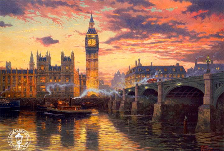
The painting that we are going to comment on is work of art by Thomas Kinkade, created in 2005. It illustrates a sunset in the centre of London and lets us see Big Ben Tower, Westminster Palace and the beautiful waters of Thames River. The style of the work is interesting to comment because its colour tones give feeling of tranquillity and this is the reason why I have chosen it. London is located in the south of England and is the political and economic capital of the UK. The city centre is located 60km from the mouth of the Thames, the river that runs through the city. The city is displayed after the Roman conquest. It is in the third century when Londinium becomes an important settlement. The Great Fire of London in 1666 destroyed the medieval city of London. The heart of the city is called the City of London which is the oldest part and from which developed gradually, what we now know as the great city of London.
This work of art depicts the central area of London. One can see in the background the Big Ben or The Elizabeth Tower, which was built in 1289 for the first time and was called the Clock Tower. Years later, in 1834 a fire destroyed it and they had to re-build by adding the four-faced clock and finally ended in 1859. On the right of the picture you can see Westminster Bridge. The first Westminster Bridge was a stone bridge built between 1738 and 1750. It was the second bridge that was made to cross the river, after the London Bridge and it has been very important in the South London development. In the foreground is the River Thames. It crosses London and has been the major route of communication and trade of the city. In the picture, one can also appreciate, behind Westminster Bridge, a series of buildings that belong to the 19th century. These buildings are today the centre of London, near Trafalgar Square and Piccadilly Circus, and coincide with the ancient City of Westminster. We can say that over the years London has become one of the most tourist cities. Every year many people from all over the world walk along the streets to visit the historical centre and other attractions.
Then we will discuss the urban layout and the town planning. We have to consider that town planning of the city has changed from the city origins to nowadays. London as a medieval city was very irregular and today, you can find this plan in the periphery but the centre is more regular. Maybe it is not an obvious example of orthogonal plan but Trafalgar Square and its surrounding area is very organized. From the 16th century the growth of the city has not had a regular shape.
We can talk about different sections in a city according to the Anglosaxon pattern. For example, the CBD (Central Business District) is the place where we can find de major trade of the city and the most importat buildings and skyscrapers. Another important thing about this area is its high land value that in London corresponds to Trafalgar Square and Piccadilly area. Furthermore, it can be recognized the inner city that is found around the CBD, the suburbs where most of the London population lives and, finally, the rural-urban fringe which is the farthest part from the city centre, where there are industrial areas and the land value is lower.
To conclude, we can say that today London is one of the most important cities in the world for its economic activity as well as political and commercial. It is also the largest urban area in Britain and across the European Union. London is a major human settlement since founded by the Romans, who called it Londinium. The City of London keeps its medieval measures, since the 19th century and the name ‹‹London›› refers to the whole metropolis that developed from this core. The bulk of this conurbation forms the London region and the Greater London administrative area, governed by the Mayor and the London Assembly.
María Rodríguez Cosmen